Description
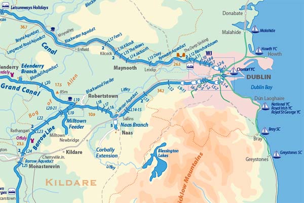 Ireland’s Waterways Map and Directory compiled by David Edwards-May and Michael Grace. Third edition of the map of inland waterways which span Ireland from north to south and east to west, together with a concise directory : information supplied by Waterways Ireland, and descriptions of each waterway by Ruth Delany. The map, compiled by David Edwards-May, shows more than 1000 kilometres of navigable canals, rivers, estuaries and lakes, open for cruising holidays in hire boats or private craft. The full-colour map shows locks, distances, navigable dimensions and boat harbours, and a useful directory gives information on administration, boat hire, waterway guides and tourist organisations. Numerous enlargements. Dimensions 100 x 68 cm. Scale 1:500 000. For printing from the pdf supplied, since the map is currently out of stock.