Description
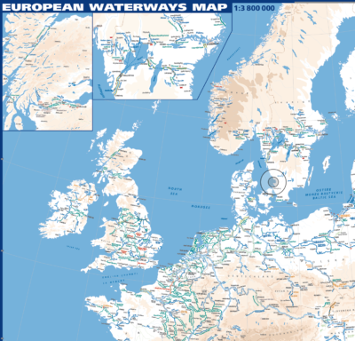
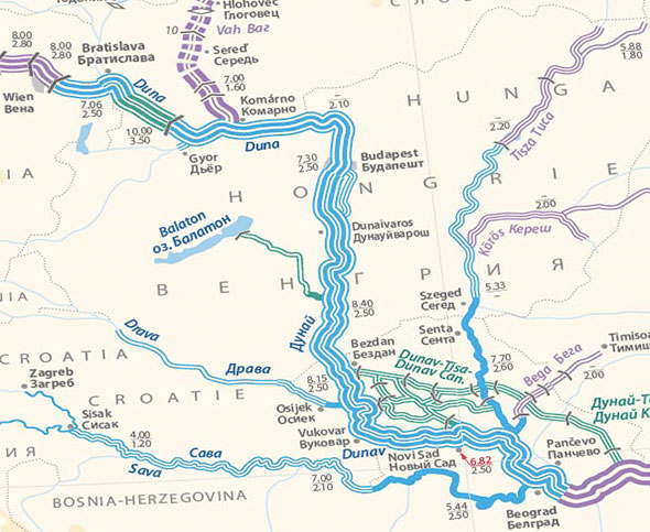 This map, more technical than our European Waterways map, will interest all those who are involved in or monitoring inland water transport. Produced by Euromapping for the UN in Geneva (working group on transport by inland waterways), it distinguishes waterways by tonnage capacity, from European Class I to Class VII. Folded, 1007 x 682 mm, scale 1:4750000. Two other maps on the reverse, at a distorted scale of approx 1:6000000, show the waterways classified by available draught and by navigability zones (determined by wave height). Trilingual: Russian, French and English. UN-ECE, 1999.