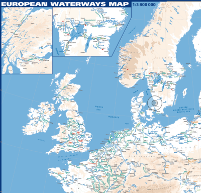
Description
First side, Europe from Ireland and Portugal to the Caspian Sea – dimensions 1210 x 870 mm
Scale 1:3 800 000
Enlargement on reverse, with unprecedented detail, covering Dublin to Bratislava on the Danube.
Scale 1:1 500 000.
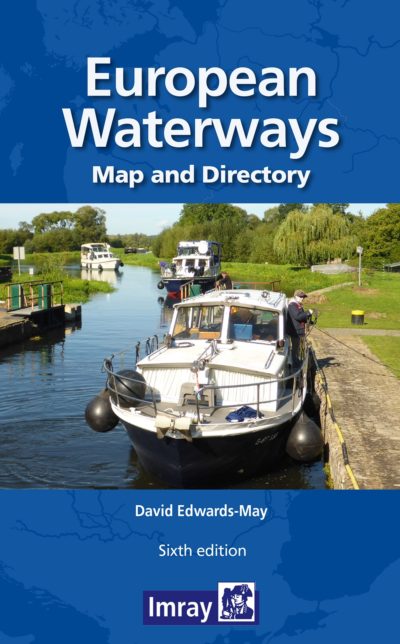
Folded in stiff cover, 290 by 156mm, with 64-page directory by David Edwards-May; brief description of waterways in each country, followed by addresses of waterway authorities, boating associations, etc. An indispensable reference
Scale 1:3 800 000
Enlargement on reverse, with unprecedented detail, covering Dublin to Bratislava on the Danube.
Scale 1:1 500 000.
Folded in stiff cover, 290 by 156mm, with 64-page directory by David Edwards-May; brief description of waterways in each country, followed by addresses of waterway authorities, boating associations, etc. An indispensable reference